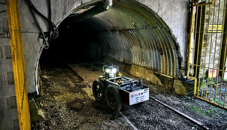
Researchers are competing to make robots that can autonomously map and navigate an underground mine.
The first scored event in the multi-year DARPA Subterranean Challenge will take place from August 15-22 in the research mine the National Institute for Occupational Safety and Health operates in South Park Township, outside of Pittsburgh.
Explorer, a team from Carnegie Mellon University, is one of 11 teams qualified to compete in the event, where the robots will face a mine disaster scenario. Judges will score the robots on their ability to develop a 3D map of the mine and identify a variety of objects positioned in the mine, including simulated human survivors.
“This is a task that requires robot autonomy, perception, networking, and mobility for us to be successful,” says Sebastian Scherer, who leads the team with Matt Travers, both of whom are faculty members at Carnegie Mellon’s Robotics Institute. The team, which includes about 30 faculty, staff members, and students, has tested its robots and procedures extensively at the Tour-Ed Mine in Tarentum, Pennsylvania.
One of the major challenges has been maintaining communications between the robots and with the human operator who oversees them from outside the mine, says Steven Willits, Explorer’s lead test engineer. The rock walls block radio signals, which means radios are largely useless unless they are in line of sight with each other. So the ground robots, named Rocky 1 and Rocky 2, periodically drop Wi-Fi nodes on the mine floor, creating a communications network as they go.
Even so, the number of nodes they carry is limited, so the robots eventually must venture beyond their ad hoc network, operating autonomously to gather data, says Kevin Pluckter, a master’s student in robotics who is the lead operator. The robots will relay that information back to the operator once they return within range of the Wi-Fi network.
Under the competition’s rules, the teams will have 60 minutes to complete their mapping and search missions. Rocky 1 and Rocky 2 both are capable of running the entire time, but the drones have more limited flight times. The drones will be useful when the ground robots meet an obstruction that they can’t surmount, flying ahead to complete the mission.
The Tunnel Circuit is one of three circuit events that lead up to the final event. Researchers and their robots will face an Urban Circuit, in which robots will explore complex underground facilities, in February 2020 and a Cave Circuit in August 2020. Researchers will compete a final event incorporating all three environments in August 2021 to determine the winner of the competition’s $2 million grand prize.
The challenge will develop technologies military and civilian first responders need when facing damaged, potentially unsafe underground environments.
Explorer competes in the Subterranean Challenge’s systems track, in which the teams develop physical robotic systems that compete in live environments. The challenge also includes a virtual track, in which teams develop software and algorithms and compete in simulation-based events. Nine teams began the virtual competition in July; the winners will be announced during this month’s event.
The Defense Advanced Research Projects Agency funds the competition. Additional funding came from the Richard King Mellon Foundation, Schlumberger, Microsoft, Boeing, FLIR Systems, Near Earth Autonomy, Epson, Lord, and Doodle Labs.
Source: Carnegie Mellon University
The post Watch: Robot maps underground mine with Wi-Fi ‘breadcrumb trail’ appeared first on Futurity.
from Futurity https://ift.tt/2Z3nHht
No comments:
Post a Comment